OFFICIAL
DESCRIPTION CHANGE
OFFICE:
Research and Analytics
EFFECTIVE
DATE: 12-28-17
SUBMITTED
BY: Paul Mauer
ENTERED
DATE: 10-17-19
DISCUSSION/BACKGROUND:
Transfer of jurisdiction agreement number
2014-TJ-010, between Van Buren County and the Iowa Department of Transportation
transferred the entire portion of IA 98 to Van Buren County effective December
28, 2017.
PROPOSAL/ACTION
RECOMMENDATION:
It is recommended that IA 98 be removed from the
Primary Road System records.
COMMISSION
ORDER
DIVISION: Planning & Research
COMMISSION
ORDER NUMBER:
PR-79-272
SUBMITTED
BY: C.I. MacGillivray
MEETING
DATE:
11-2-78
TITLE: Iowa 98, Van Buren County,
DISCUSSION/BACKGROUND:
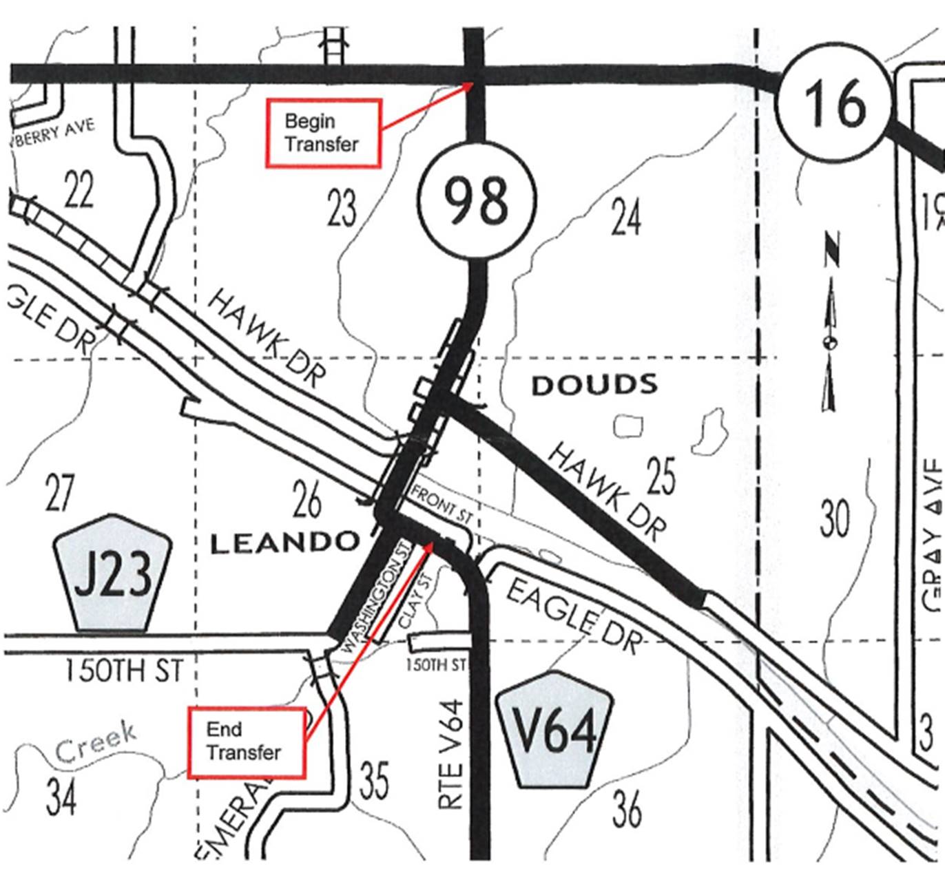
Iowa
98 begins in the unincorporated town of Leando
approximately 3 miles south and 7 ½ miles west of Birmingham, and travels
generally northwesterly, northeasterly, and northerly approximately 2 miles to
Iowa 16.
Due
to a review of our Primary Road System Records Iowa 98 in Van Buren County
should be deleted and the new description added should be officially included
into the Primary System.
PROPOSAL/ACTION
RECOMMENDATION:
It
is recommended that the old description of Iowa 98 in Van Buren County be
deleted and the new description, as referred in the attached detailed
description, be included in the Primary Road System effective upon the adoption
of this resolution.
Locate
Iowa 98 in Van Buren County as follows:
Beginning
on an unnamed street at
OFFICIAL
DESCRIPTION CHANGE
COUNTY: Van Buren
ROUTE: Iowa 98
APPROVAL
DATE: 7-9-47
Beginning
on Main Street at the easterly line of Clay Street in the unincorporated town
of Leando; thence westerly along Main Street
approximately 975 feet to Jefferson Street; thence northerly on Jefferson
Street one block to the southerly end of the Des Moines River bridge; thence
northeasterly across the Des Moines River bridge approximately 700 feet to the
unincorporated village of Douds at Front and Main
Streets; thence northeasterly through Douds on Main
Street to a point approximately 916 feet north of the SE Corner Section 23-T70N‑R11W;
thence north following substantially the section line to the NW Corner Section
24‑T70N‑R11W intersecting Iowa 16.