OFFICIAL
DESCRIPTION CHANGE
OFFICE:
Research and Analytics
EFFECTIVE
DATE: 8-19-2019
COUNTY:
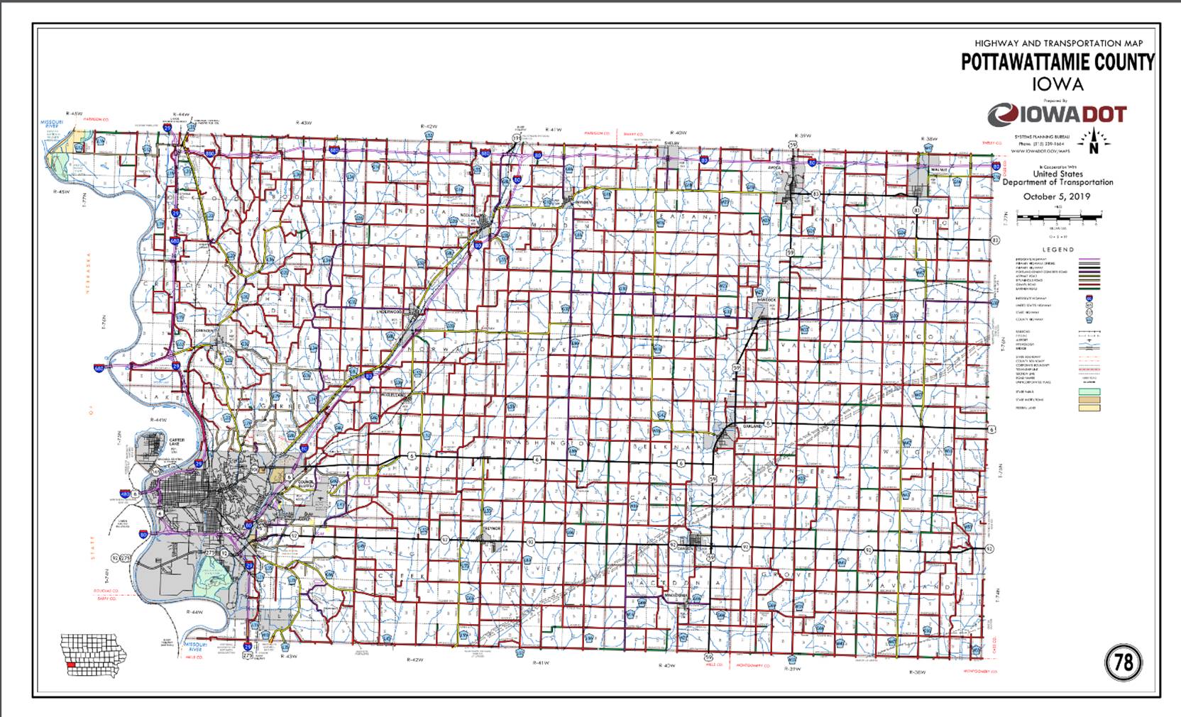
Pottawattamie
ROUTE:
Interstate 80
ENTERED
BY: Paul Mauer
ENTERED
DATE: 12-20-2019
New
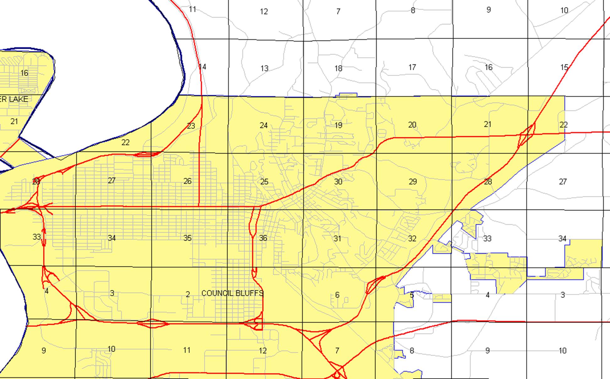
Description - Interstate 80 and its extensions in
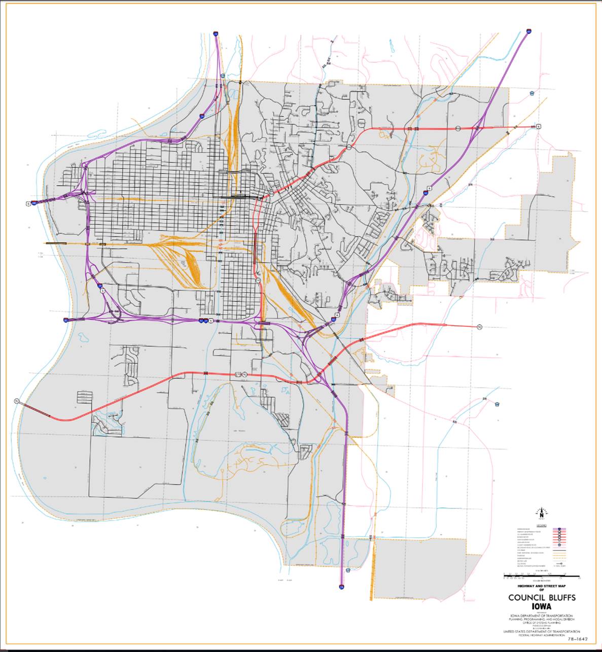
Council Bluffs
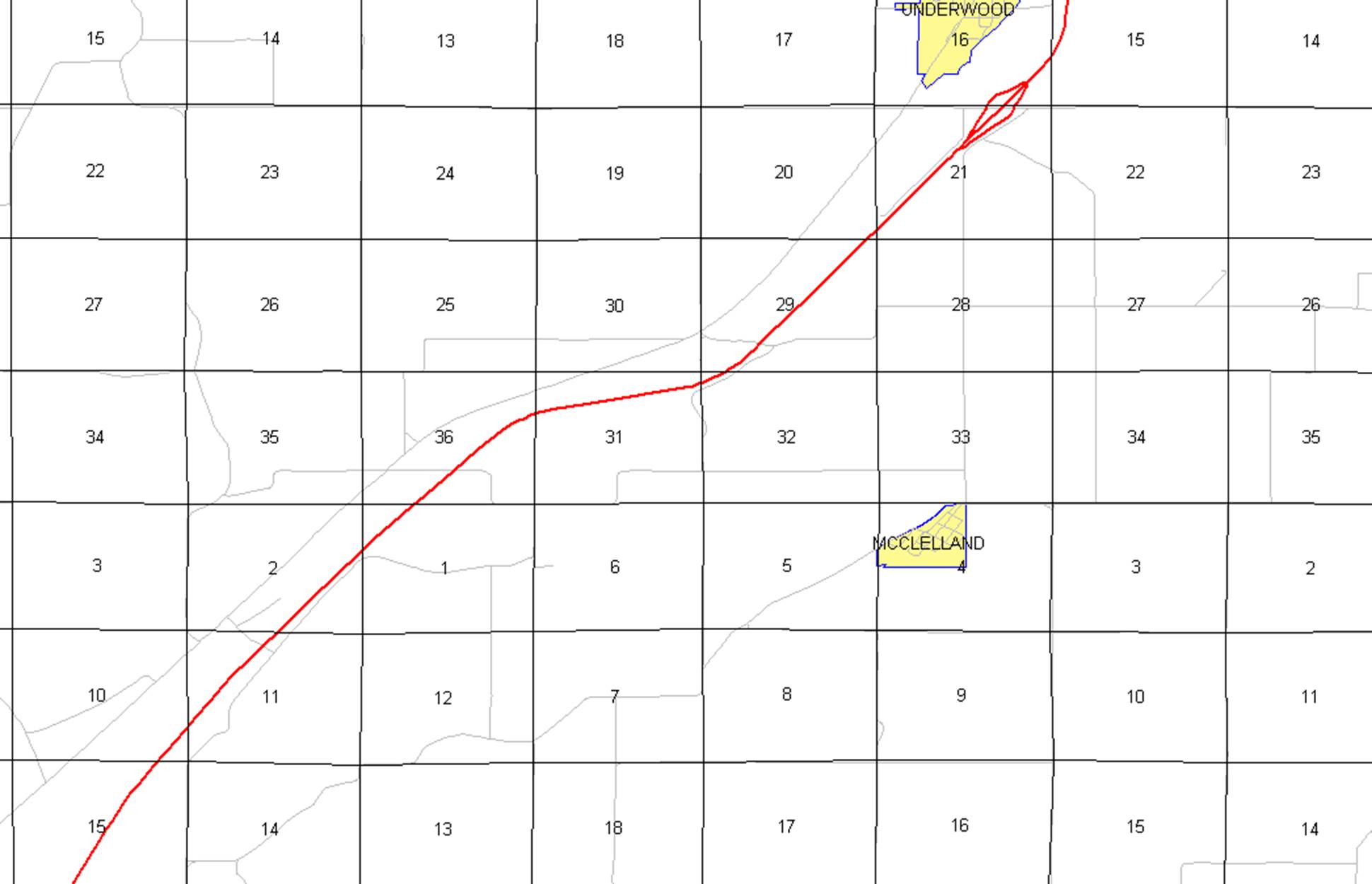
Beginning
at the Iowa-Nebraska State line (west corporation line) (approximately 4483
feet west and 624 feet south of the NE Corner Section 9-T74N-R44W); thence
easterly through Sections 9, 10 (west junction of Interstate 29 and US 6), 11,
and 12-T74N-R44W (junction Iowa 192) to a point approximately 2160 feet west
and 200 feet south of the NE Corner of said Section 12; thence easterly through
Section 12 and Section 7-T74N-R43W to the east junction of Interstate 29;
thence northeasterly through Sections 7, 6,
and 5-T74N-R43W and Sections 32, 28, 21, and 22-T75N-R43W (east junction
of US 6 and junction of Iowa 906) to the north corporation line (approximately
2132 feet east of the NW Corner of said Section 22).
Beginning
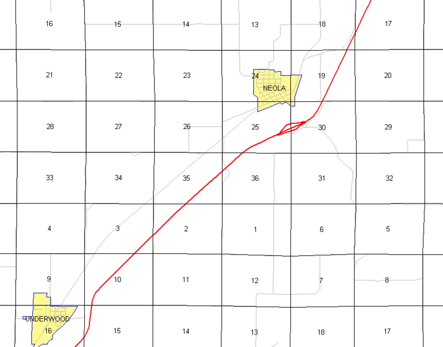
again on the north corporation line of Council Bluffs; thence northeasterly
through Sections 15, 10, 11, 2, and 1-T75N-R43W, Section 36-T76N-R43W, Sections
31, 32, 29, 20, 21, 16, 15, 10, 3, and
2-T76N-R42W, Sections 35, 36, and 25-T77N-R42W, and Sections 30, 19, 18, 17, 8 and 5-T77N-R41W to the
junction of Interstate 680 (approximately the Center of said Section 5); thence
easterly through the center part of Sections 5, 4, 3, 2, and 1‑T77N‑R41W,
Sections 6, 5 and 4-T77N-R40W to the west corporation line of Shelby.
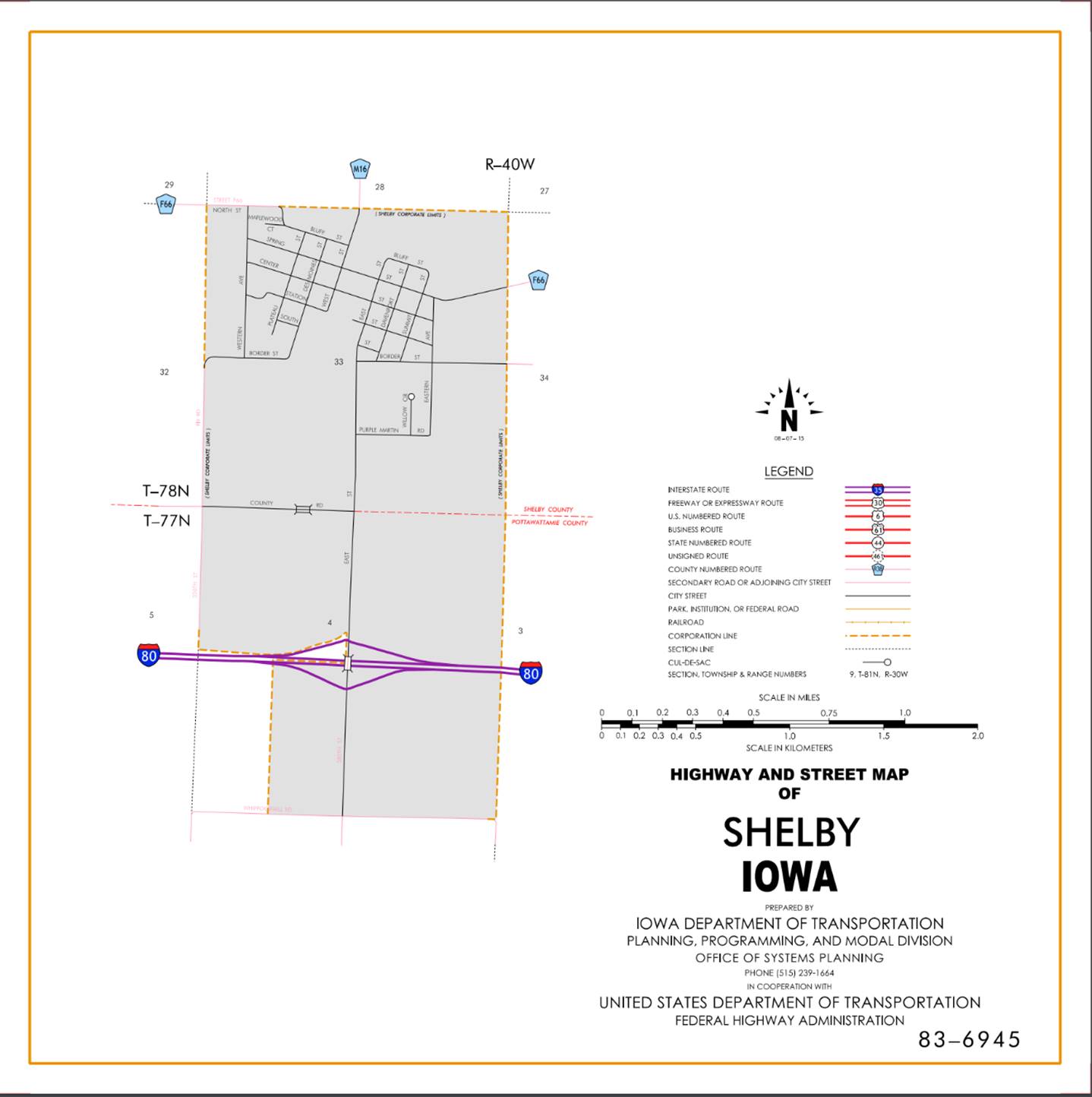
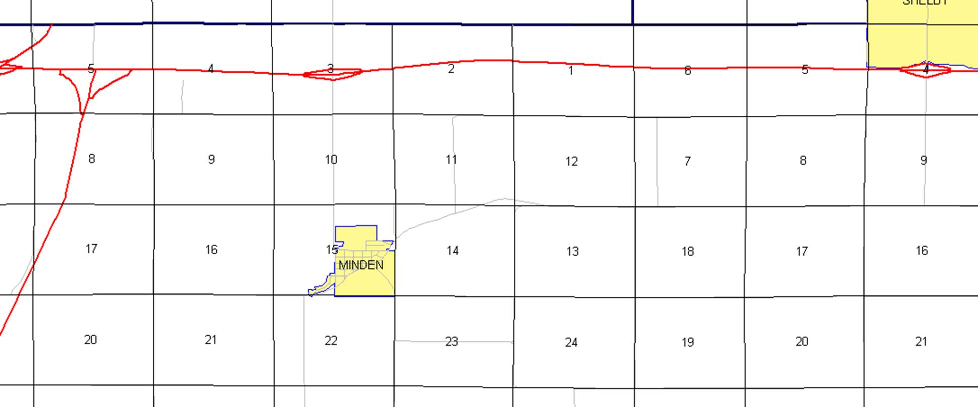
Shelby:
Beginning
at the west corporation line; then east to the east corporation line.
Beginning
again at the east corporation line of Shelby; thence east through Sections 3, 2
and 1‑T77N‑R40W and Sections 6, 5, 4, (junction US 59) 3, 2 and 1‑T77N‑R39W
and Sections 6 and 5‑T77N‑R38W to the west corporation line of
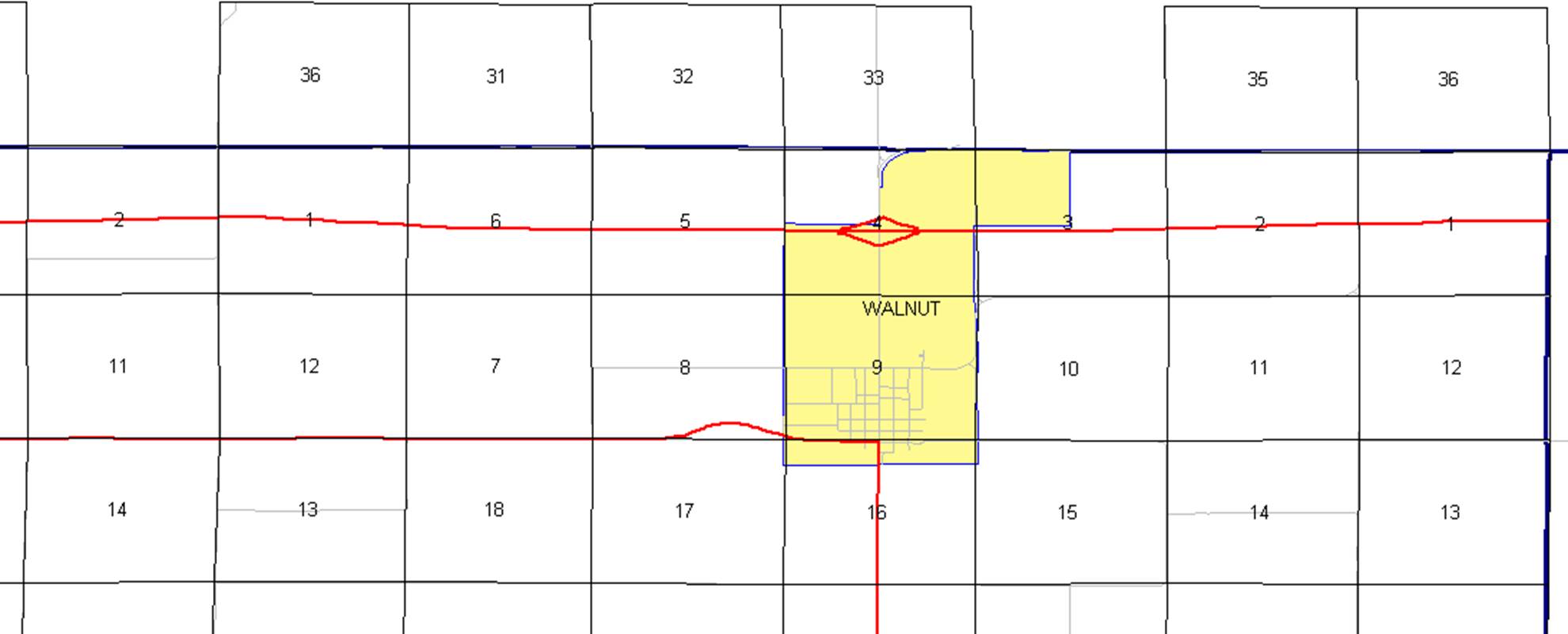
Walnut (approximately 270 feet south of the E ¼ Corner of said Section 5).

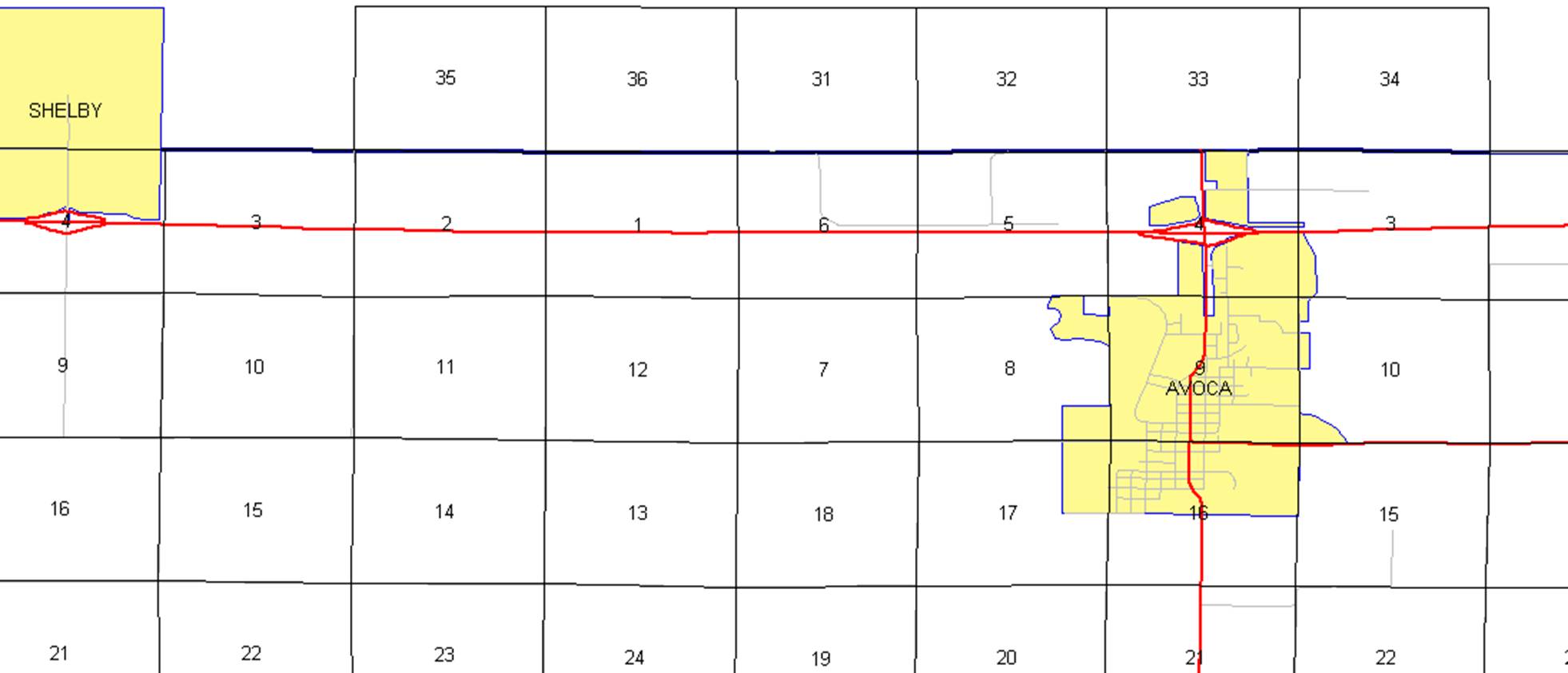
Walnut:
Beginning
at the west corporation line; thence easterly to the east corporation line
(approximately 258 feet south and 112 feet west of the E ¼ Corner Section
4-T77N-R38W).
Beginning again on the east corporation line of Walnut; thence easterly through
Sections 4, 3, 2, and 1‑T77N‑R38W to the Pottawattamie‑Cass
County line at a point near the E ¼ Corner Section 1‑T77N‑R38W,
Pottawattamie county (W ¼ Corner Section 6‑T77N‑R37W Cass County).
OFFICIAL
DESCRIPTION CHANGE
OFFICE: Transportation Data
ENTERED
BY: Stefani Wonders
ENTERED
DATE: 09-13-2006
DISCUSSION/BACKGROUND:
Due
to a review of our Primary System records, the primary route description for
Interstate 80 in
PROPOSAL/ACTION
RECOMMENDATION:
New
Description - Interstate 80 and its extensions in
Council Bluffs
Beginning
on an unnamed street at the Iowa-Nebraska State line (west corporation line)
(approximately 4483 feet west and 624 feet south of the NE Corner Section
9-T74N-R44W); thence easterly through Sections 9, 10, 11, and 12-T74N-R44W to a
point approximately 2160 feet west and 200 feet south of the NE Corner of said
Section 12; thence southeasterly through Section 12 and Section 7-T74N-R43W to
the east junction of Interstate 29 (approximately 1574 feet south and 646 feet
east of the NW Corner of said Section 7); thence northeasterly through Sections
7, 6, and 5-T74N-R43W and Sections 32,
28, 21, and 22-T75N-R43W to the north corporation line (approximately 2132 feet
east of the NW Corner of said Section 22).
Beginning
again on the north corporation line of Council Bluffs connecting with an
unnamed street; thence northeasterly through Sections 15, 10, 11, 2, and
1-T75N-R43W, Section 36-T76N-R43W, Sections 31, 32, 29, 20, 21, 16, 15, 10, 3, and 2-T76N-R42W,
Sections 35, 36, and 25-T77N-R42W, and Sections
30, 19, 18, 17, 8 and 5-T77N-R41W to the junction of Interstate 680
(approximately the Center of said Section 5); thence easterly through the
center part of Sections 5, 4, 3, 2, and 1‑T77N‑R41W, Sections 6, 5,
4, 3, 2 and 1‑T77N‑R40W and Sections 6, 5, 4, (junction US 59) 3, 2
and 1‑T77N‑R39W and Sections 6 and 5‑T77N‑R38W to the
west corporation line of Walnut connecting with an unnamed street
(approximately 270 feet south of the E ¼ Corner of said Section 5).
Walnut:
Beginning
on an unnamed street at the west corporation line; thence easterly to the east
corporation line (approximately 258 feet south and 112 feet west of the E ¼
Corner Section 4-T77N-R38W).
Beginning again on the east corporation line of Walnut connecting with an
unnamed street; thence easterly through Sections 4, 3, 2, and 1‑T77N‑R38W
to the Pottawattamie‑Cass County line at a point near the E ¼ Corner
Section 1‑T77N‑R38W, Pottawattamie county (W ¼ Corner Section 6‑T77N‑R37W
Cass County).
COMMISSION ORDER
DIVISION: Planning & Research
COMMISSION
ORDER NUMBER:
PR-79-272
SUBMITTED
BY: C.I. MacGillivray
MEETING
DATE:
11-2-78
DISCUSSION/BACKGROUND:
Due
to a review of our Primary Road System records Interstate 80 in
Interstate
80 begins on the Iowa‑Nebraska State line at the west corporation line of
PROPOSAL/ACTION
RECOMMENDATION:
Locate
Interstate 80 and its extension in
Beginning
on an unnamed street on the Interstate 80 Bridge over the Missouri River at the
Iowa‑Nebraska State line (west corporation line); thence easterly near
the approximate section line through Sections 9, 4, 3, 2 and 1‑T74N‑R44W
to a point near the S ¼ Corner Section 1‑T74N‑R44W; thence
southeasterly and northeasterly through Sections 1 and 12‑T74N‑R44W,
Sections 7, 6 and 5‑T74N‑R43W and Sections 32, 29, 28, 21 and
22-T75N-R43W to the north corporation line connecting with an unnamed street.
Beginning
on the north corporation line of the City of Council Bluffs connecting with an
unnamed street; thence northeasterly through Sections 15, 10, 11, 2 and 1-T75N-R43W;
Section 36‑T76N‑R43W; Sections 31, 32, 29, 20, 21, 16, 15, 10, 3
and 2‑T76N‑R42W; Sections 35, 36 and 25‑T77N‑R42W, and
Sections 30, 19, 18, 17, 8 and 5‑T77N‑R41W to a point (junction
Interstate 680) near the center of Section 5‑T77N‑R41W; thence
easterly through the center part of Sections 5, 4, 3, 2, and 1‑T77N‑R41W,
Sections 6, 5, 4, 3, 2 and 1‑T77N‑R40W and Sections 6, 5, 4,
(junction US 59) 3, 2 and 1‑T77N‑R39W and Sections 6, 5, 4, 3, 2,
and 1‑T77N‑R38W to the Pottawattamie‑Cass County line at a
point near the E ¼ Corner Section 1‑T77N‑R38W, Pottawattamie county
(W ¼ Corner Section 6‑T77N‑R37W Cass County).
NOW,
THEREFORE: Be it resolved that the Iowa Department of Transportation approve
the location of Interstate 80 in
NOTE:
To become effective upon the adoption of this resolution.
COMMISSION
RESOLUTION
DIVISION: Planning & Research
COMMISSION
ORDER NUMBER:
74-772
SUBMITTED
BY: Gene R. Mills
MEETING
DATE:
6-26-74
Locate
Interstate 80 and its extension in
Beginning
on the north corporation line of the City of Council Bluffs connecting with an
unnamed street; thence northeasterly through Sections 15, 10, 11, 2 and 1‑T75N‑R43W;
thence northeasterly through Section 36‑T76N‑R43W; thence northeasterly
through Sections 31, 32, 29, 20, 21, 16, 15, 10, 3 and 2-T76N‑R42W;
thence northeasterly through Sections 35, 36, and 25‑T77N‑R42W;
thence northeasterly through Sections 30, 19, 20, 17, 8 and 5‑T77N‑R41W
to a point near the center of Section 5‑T77N‑R41W (junction
Interstate 680); thence easterly through approximately the center of Sections
5, 4, 3, 2 and 1‑T77N‑R41W; thence easterly through approximately
the center of Sections 6, 5, 4, 3, 2 and 1‑T77N‑R40W; thence
easterly through approximately the center of Sections 6, 5, 4, 3, 2 and 1‑T77N‑R39W;
thence easterly through approximately the center of Sections 6, 5, 4, 3, 2 and
1‑T77N‑R38W; thence easterly to the Pottawattamie‑Cass County
line at a point near the NE Corner SE ¼ Section 1-T77N‑R38W,
Pottawattamie County (NW Corner SW ¼ Section 6‑T77N‑R37W (Cass
County).
Beginning
on the Interstate 80 Bridge over the Missouri River Bridge at the Iowa‑Nebraska
State line (west corporation line); thence easterly along the approximate
section line (parallel to 29th Avenue) to a point near the N ¼ Corner of
Section 12-T74N-R44W (near intersection of 29th Avenue and South 4th Street);
thence southeasterly, easterly, and northeasterly to a point on Pomona Avenue
midway between Madison Avenue and Mosquito Creek; thence northeasterly
approximately paralleling the Chicago Great Western Railroad to the north
corporation line of Council Bluffs.
NOW,
THEREFORE: Be it resolved that the Iowa
State Highway Commission approve the location of Interstate 80 and its
extension in Pottawattamie County, Iowa.
COMMISSION
RESOLUTION
DIVISION: Planning & Research
COMMISSION
ORDER NUMBER:
74-15
MEETING
DATE: 1-9-74
Remove
Interstate 80N in
Beginning
at a point on Interstate 29 near the SE Corner of Section 4-T77N-R44W; thence
in an easterly direction through the south part of Sections 4, 3, 2 and 1‑T77N‑R44W;
thence continuing in an easterly direction through Sections 6 and 5‑T77N‑R43W
to a point near the S ¼ Corner Section 5‑T77N‑R43W; thence in a
northeasterly direction through Sections 5 and 4‑T77N‑R43W to a
point near the center of Section 4‑T77N‑R43W; thence in an easterly
direction following substantially the quarter section line to a point near the
NE Corner SE ¼ Section 5‑T77N‑R41W.
NOW,
THEREFORE: Be it resolved that the Iowa State Highway Commission approve the
removal of Interstate 80N in
NOTE:
To become effective upon adoption of this resolution.
OFFICIAL
DESCRIPTION CHANGE
COUNTY: Pottawattamie
ROUTE: Interstate 80N
APPROVAL
DATE: 12-7-68
Beginning
at a point on Interstate 29 near the SE Corner of Section 4‑T77N‑R44W;
thence in an easterly direction through the south part of Sections 4, 3, 2, and
1‑T77N‑R44W; thence continuing in an easterly direction through
Sections 6 and 5‑T77N‑R43W to a point near the S ¼ Corner Section 5‑T77N‑R43W;
thence in a northeasterly direction through Sections 5 and 4‑T77N‑R43W
to a point near the center of Section 3‑T77N‑R43W; thence in an
easterly direction following substantially the quarter section line through
Sections 3, 2, 1-T77N-R43W and Sections 6, 5, 4, 3, 2, and 1-T77N-R42W and
Sections 6 and 5-T77N-R41W to a point near the NE Corner SE ¼ Section
5-T77N-R41W.
OFFICIAL
DESCRIPTION CHANGE
COUNTY: Pottawattamie
ROUTE: Interstate 80
APPROVAL
DATE: 12-7-66
Beginning
at a point near the NW Corner SW ¼ of Section 5‑T77N‑R41W; thence
in an easterly direction following substantially the quarter section line to
the Pottawattamie‑Cass County line at a point near the NE Corner SE ¼
Section 1-T77N-R38W, Pottawattamie County (NW Corner SW Section 6-T77N-R37W,
Cass County).
Adopted
12-7-66
BE
IT RESOLVED by the Iowa State Highway Commission that the following described
road in
Access
Control Classification:
This
section of road upon completion and opening to traffic will be a Class I Road.
BE
IT FURTHER RESOLVED that the attached description of Interstate 80 in