OFFICIAL
DESCRIPTION CHANGE
OFFICE:
Transportation Data
EFFECTIVE DATE: 12-02-2004
ENTERED
BY: Stefani Wonders
ENTERED
DATE: 02-11-2005
DISCUSSION/BACKGROUND:
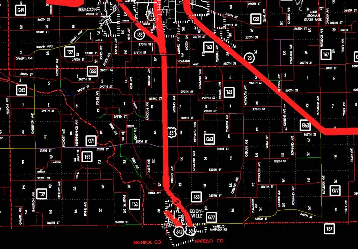
Transfer of jurisdiction agreement number 2003-TJ-045, between Mahaska
County and the Iowa Department of Transportation, transferred that portion of
Unsigned Iowa 342 from 8th
Street at the north corporation line of Eddyville (approximately 2600 feet
south and 90 feet east of the NE Corner of said Section 31); thence northerly
following substantially the section line of Sections 31 and 30-T74N-R15W to
approximately 1350 feet south of the W ¼ Corner of said Section 30 to county
jurisdiction on December 2, 2004.
PROPOSAL/ACTION
RECOMMENDATION:
New Description – US 63 and its extensions in Mahaska County described as follows:
Beginning at
the Mahaska-Warren County line approximately 400 feet west of the SE Corner of
Section 31-T74N-R15W; thence northwesterly through Sections 31 and 30-T74N-R15W
to a point near the W ¼ Corner of said Section 30; thence northerly following
substantially the west section line of Sections 30, 19, 18, 7, and 6-T74N-R15W
and Section 31-T75N-R15W to a point near the W ¼ Corner of said Section 31;
thence northwesterly through Sections 36 and 25-T75N-R16W to the south
corporation line of Oskaloosa (approximately 1300 feet south and 1030 feet west
of the NE Corner of said Section 25) connecting with Market Street.
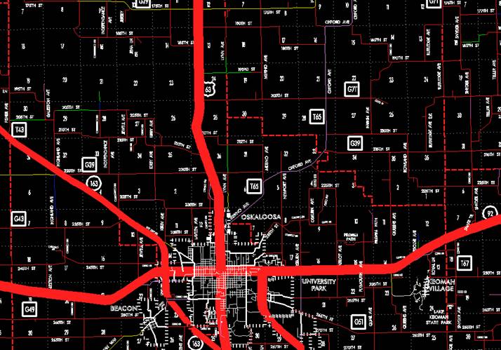
Oskaloosa:
Beginning on
the south corporation line connecting with Market Street; thence north on Market Street to
the north corporation line (approximately 660 feet south and 1340 feet west of
the NE Corner of Section 12-T75N-R16W).
Beginning
again on the north corporation line of Oskaloosa connecting with Market Street;
thence northerly and northwesterly through Sections 12 and 1-T75N-R16W and
Sections 36 and 25-T76N-R16W to a point near the N ¼ NW ¼ Corner of said
Section 25; thence northerly through Sections 24, 13, 12, and 1-T76N-R16W to a
point approximately 1180 feet north and 2730 feet east of the SW Corner of said
Section; thence northerly following substantially the center section line of
Section 1-T76N-R16W and Sections 36, 25, and 24-T77N-R16W to the south
corporation line of New Sharon (approximately 1250 feet south and 2760 feet
east of the NW Corner of said Section 24) connecting with Main Street.
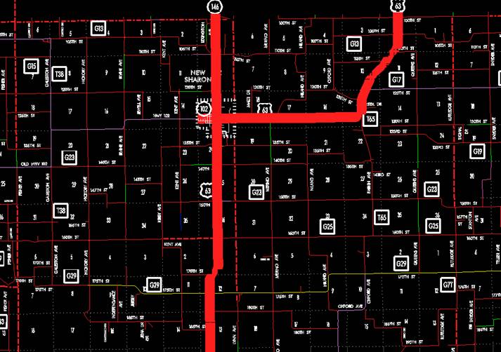
New Sharon:
Beginning on
the south corporation line connecting with Main Street; thence north on Main Street to
Market Street; thence east on Market
Street to the east corporation line (approximately
1390 feet north of the NE Corner of Section 19-T77N-R15W).
Beginning
again on the east corporation line of New Sharon connecting with Market Street;
thence easterly direction through Sections 18, 17, 16, and 15-T77N-R15W to a
point southwest of the center of said Section 15-T77N-R15W; thence curving in a
northeasterly and northerly direction through said Section 15 to a point near
the S ¼ Corner Section 10-T77N-R15W; thence in a northeasterly direction through
Section 10 and 11-T77N-R15W to a point near the S ¼ Corner Section 2-T77N-R15W;
thence north through said Section 2 to a point near the N ¼ Corner Section
2-T77N-R15W on the Mahaska-Poweshiek County line (S ¼ Corner Section
35-T78N-R15W, Poweshiek County).
STAFF ACTION
OFFICE:
Transportation Inventory
STAFF
ACTION NUMBER:
S-98-0495
SUBMITTED
BY: Patrick R. Cain
SUBMITTAL
DATE: 10-28-97
DISCUSSION/BACKGROUND:
Due to the relocation
of US 63 north of Ottumwa, and the rerouting of US 63, Iowa 23, Iowa 149 and
Iowa 137, US 63 is being routed over the section of road from Eddyville to
Oskaloosa, formerly Iowa 137.
PROPOSAL/ACTION
RECOMMENDATION:
It is
recommended that the old description of US 63 in Mahaska County be deleted from
the Primary Road System and the new description, as described in the
attachment, be included in the Primary Road System.
New
Description - US 63 and its extensions in Mahaska County described as follows:
Eddyville:
Beginning on 8th
Street at the Mahaska-Wapello County
line; thence northwest on 8th
Street to the north corporation line.
Beginning
on the north corporation line of Eddyville connecting with 8th Street; thence
northerly following substantially the section line of Sections 31, 30, 19, 18,
7, and 6-T74N-R15W and Section 31-T75N-R15W to the E ¼ Corner of Section
36-T75N-R16W; thence northwesterly through Sections 36 and 25-T75N-R16W to the
south corporation line of Oskaloosa connecting with Market Street.
Oskaloosa:
Beginning on
Market Street
at the south corporation line; thence north on Market Street to the north corporation
line.
Beginning
again on the north corporation line of Oskaloosa connection with Market Street;
thence north following substantially the east quarter section line of Sections
12 and 1-T75N-R16W to a point approximately 396 meters (1,300 feet) east and
122 meters (400 feet) north of the S ¼ Corner Section 1-T75N-R16W; thence in a
northerly and northwesterly direction through Section 1-T75N-R16W, and Section
36 and 25-T76N-R16W to a point approximately 396 meters (1,300 feet) east and
213 meters (700 feet) north of the W ¼ Corner Section 25-T76N-R16W; thence
north following substantially the west quarter section line of Sections 25, 24,
13, and 12-T76N-R16W to a point approximately 396 meters (1,300 feet) east and
244 meters (800 feet) south of the NW Corner of Section 12-T76N-R16W; thence in
an northeasterly direction through Sections 12 and 1-T76N-R16W to a point
approximately 396 meters (1,300 feet) north of the S ¼ Corner of Section
1-T76N-R16W; thence north following substantially the center section line of
Section 1-T76N-R16W, and Sections 36, 25, and 24-T77N-R16W to the south
corporation line of New Sharon connecting with Main Street.
New Sharon:
Beginning on
Main Street
at the south corporation line; thence north on Main Street to Market Street; thence east on Market Street to
the east corporation line.
Beginning
again on the east corporation line of New Sharon connecting with Market Street;
thence in an easterly direction through Sections 18, 17, 16, and 15-T77N-R15W
to a point southwest of the center of said Section 15-T77N-R15W; thence curving
in a northeasterly and northerly direction through said Section 15 to a point
near the S ¼ Corner Section 10-T77N-R15W; thence in a northeasterly direction
through Section 10 and 11-T77N-R15W to a point near the S ¼ Corner Section
2-T77N-R15W; thence north through said Section 2 to a point near the N ¼ Corner
Section 2-T77N-R15W on the Mahaska-Poweshiek County line (S ¼ Corner Section
35-T78N-R15W, Poweshiek County).
OFFICIAL
DESCRIPTION CHANGE
COUNTY:
Mahaska
ROUTE:
US 63
STAFF
ACTION NUMBER: S-87-1533
APPROVAL
DATE: 5-13-87
New
Description - US 63 and its extensions in Mahaska County described as follows:
Beginning at
a point near the SE Corner of Section 36‑T74N‑R14W, Mahaska County
(SW Corner of Section 31‑T74N‑R13W, Keokuk County) (NW Corner of
Section 6‑T73N‑R13W, Wapello County);
thence north along the Mahaska‑Keokuk County line (see Keokuk County) to
a point approximately 800 feet south of the NE Corner of Section 24‑T74N‑R14W,
Mahaska County (NW Corner Section 19‑T74N‑R13W, Keokuk County);
thence curving in a northwesterly direction to a point approximately 400 feet
west of the NE Corner of Section 24‑T74N‑R14W; thence in a
northwesterly direction through Section 13‑T74N‑R14W to the east
corporation line of Fremont, connecting with an unnamed street.
Fremont:
Beginning on
an unnamed street at the east corporation line; thence northwest on unnamed
street to Main Street; thence west on Main
Street to the west corporation line.
Beginning
again on the west corporation line of Fremont, connecting with Main Street; thence
west following substantially the center section line of Sections 14, 15, 16, 17
and 18‑T74N‑R14W to a point approximately 800 feet east of the W ¼
Corner of Section 18‑T74N‑R14W; thence in a northwesterly direction
through Sections 18‑T74N‑R14W; Sections 13, 12, 11, 2 and 3‑T74N‑R15W,
and Sections 34, 33, 28 and 29‑T75N‑R15W to the south corporation
line of University Park, connecting with an unnamed street.
University Park:
Beginning on
an unnamed street at the south corporation line; thence northwest on unnamed
street to the west corporation line (east corporation line of the Oskaloosa).
Oskaloosa:
Beginning on
17th Street
at the east corporation line (west corporation line of University Park); thence northwest and north
on 17th Street
to "A" Avenue; thence west on "A"
Avenue to Market Street;
thence north on Market Street
to the north corporation line.
Beginning
again on the north corporation line of Oskaloosa connecting with Market Street;
thence north following substantially the east quarter section line of Sections
12 and 1‑T75N‑R16W to a point approximately 1,300 feet east and 400
feet north of the S ¼ Corner Section 1‑T75N‑R16W; thence in a
northerly and northwesterly direction through Section 1‑T75N‑R16W,
and Section 36 and 25‑T76N‑R16W to a point approximately 1,300 feet
east and 700 feet north of the W ¼ Corner Section 25‑T76N‑R16W;
thence north following substantially the west quarter section line of Sections
25, 24, 13, and 12‑T76N‑R16W to a point approximately 1,300 feet
east and 800 feet south of the NW Corner of Section 12‑T76N‑R16W;
thence in a northeasterly direction through Sections 12 and 1‑T76N‑R16W
to a point approximately 1,300 feet north of the S ¼ Corner of Section 1‑T76N‑R16W;
thence north following substantially the center section line of Section 1‑T76N‑R16W,
and Sections 36, 25, and 24‑T77N‑R16W to the south corporation line
of New Sharon connecting with Main Street.
New Sharon:
Beginning on
Main Street
at the south corporation line; thence north on Main Street to Market Street; thence east on Market Street to
the east corporation line.
Beginning
again on the east corporation line of New Sharon connecting with Market Street;
thence in an easterly direction through Sections 18, 17, 16, and 15‑T77N‑R15W
to a point southwest of the center of said Section 15‑T77N‑R15W;
thence curving in a northeasterly and northerly direction through said Section
15 to a point near the S ¼ Corner Section 10‑T77N‑R15W; thence in a
northeasterly direction through Section 10 and 11‑T77N‑R15W to a
point near the S ¼ Corner Section 2‑T77N‑R15W; thence north through
said Section 2 to a point near the N ¼ Corner Section 2‑T77N‑R15W
on the Mahaska‑Poweshiek County line (S ¼ Corner Section 35‑T78N‑R15W,
Poweshiek County).
COMMISSION
ORDER
DIVISION:
Planning & Research
COMMISSION
ORDER NUMBER:
PR-79-272
SUBMITTED
BY: C.I. MacGillivray
MEETING
DATE: 11-2-78
DISCUSSION/BACKGROUND:
Due to a
review of our Primary Road System records, US 63 in Mahaska County should be
deleted from the Primary Road System and the new description added should be
officially included into the Primary Road System.
US 63 begins
in the southeast corner of Mahaska County and travels in a northwesterly and
northerly direction to the Mahaska‑Poweshiek County line approximately 2
½ miles north of New Sharon via the cities of Fremont, University Park,
Oskaloosa and New Sharon, Iowa.
PROPOSAL/ACTION
RECOMMENDATION:
Locate US 63
and its extensions in Mahaska
County as follows:
Beginning at
a point near the SE Corner of Section 36‑T74N‑R14W, Mahaska County
(SW Corner of Section 31‑T74N‑R13W, Keokuk County)(NW Corner of
Section 6‑T73N‑R13W, Wapello County);
thence north along the Mahaska‑Keokuk County line (see Keokuk County) to
a point approximately 800 feet south of the NE Corner of Section 24‑T74N‑R14W,
Mahaska County (NW Corner Section 19‑T74N‑R13W, Keokuk County);
thence curving in a northwesterly direction to a point approximately 400 feet
west of the NE Corner of Section 24‑T74N‑R14W; thence in a
northwesterly direction through Section 13-T74N-R14W to the east corporation
line of the City of Fremont, connecting with an unnamed street.
Fremont:
Beginning
at the east corporation line connecting with an unnamed street; thence
northwesterly and westerly to the west corporation line connecting with an
unnamed street.
Beginning
again on the west corporation line of the City of Fremont, connecting with an
unnamed street; thence west following substantially the center section line of
Sections 14, 15, 16, 17, and 18‑T74N‑R14W to a point approximately
800 feet east of the W ¼ Corner of Section 18‑T74N‑R14W; thence in
a northwesterly direction through Sections 18‑T74N‑R14W; Sections
13, 12, 11, 2 and 3‑T74N‑R15W, and Section 34, 33, 28 and 29-T75N‑R15W
to the south corporation line of the City of University Park, connecting with
an unnamed street.
University Park:
Beginning
on the south corporation line connecting with an unnamed street; thence northwesterly
to the west corporation line (east corporation line of the City of Oskaloosa) connecting
with an unnamed street.
Oskaloosa:
Beginning on
the east corporation line (west corporation line of the City of University Park)
connecting with an unnamed street; thence northerly, westerly and northerly to
the north corporation line connecting with an unnamed
street.
Beginning
again on the north corporation line of the City of Oskaloosa connecting with an
unnamed street; thence north following substantially the east quarter section
line of Sections 12 and 1‑T75N‑R16W to a point approximately 1300
feet east and 400 feet north of the S ¼ Corner Section 1‑T75N‑R16W;
thence in a northerly and northwesterly direction through Section 1‑T75N‑R16W,
and Section 36 and 25‑T76N‑R16W to a point approximately 1300 feet
east and 700 feet north of the W ¼ Corner Section 25‑T76N‑R16W;
thence north following substantially the west quarter section line of Sections
25, 24, 13, and 12‑T76N‑R16W to a point approximately 1300 feet
east and 800 feet south of the NW Corner of Section 12-T76N-R16W; thence in a
northeasterly direction through Sections 12 and 1‑T76N‑R16W to a
point approximately 1300 feet north of the S ¼ Corner of Section 1‑T76N‑R16W;
thence north following substantially the center section line of Section 1‑T76N‑R16W,
and Sections 36, 25, and 24-T77N-R16W to the south corporation line of the City
of New Sharon connecting with an unnamed street.
New Sharon:
Beginning
on the south corporation line connecting with an unnamed street; thence
northerly and easterly to the east corporation line, connecting with an unnamed
street.
Beginning
again on the east corporation line of the City of New Sharon connecting with an
unnamed street; thence in an easterly direction through Section 18, 17, 16, and
15‑T77N‑R15W to a point southwest of the center of said Section 15‑T77N‑R15W;
thence curving in a northeasterly and northerly direction through said Section
15 to a point near the S ¼ Corner Section 10‑T77N‑R15W; thence in a
northeasterly direction through Section 10 and 11‑T77N‑R15W to a
point near the S ¼ Corner Section 2‑T77N‑R15W; thence north through
said Section 2 to a point near the N ¼ Corner Section 2‑T77N‑R15W
on the Mahaska‑Poweshiek County line (S ¼ Corner Section 35‑T78N‑R15W,
Poweshiek County).
NOW,
THEREFORE: Be it resolved that the Iowa
Department of Transportation approve the location of US 63, Mahaska County, Iowa.
NOTE: To become effective upon the adoption of this
resolution.
REVISED: 5-13-87
OFFICIAL
DESCRIPTION CHANGE
COUNTY:
Mahaska
ROUTE:
US 63
APPROVAL
DATE: 11-28-62
Beginning at
a point near the SE Corner of Section 36‑T74N‑R14W, Mahaska County
(SW Corner of Section 31‑T74N‑R13W, Keokuk County)(NW Corner of Section
6‑T73N‑R13W, Wapello County);
thence north along the Mahaska-Keokuk County line to a point approximately 800
feet south of the NE Corner of Section 24‑T74N‑R14W, Mahaska County
(NW Corner Section 19‑T74N‑R13W, Keokuk County); thence curving in
a northwesterly direction to a point on the south side of the Minneapolis and
St. Louis Railroad approximately 400 feet west of the NE Corner of Section 24‑T74N‑R14W;
thence in a northwesterly direction along the south side of said railroad and
substantially parallel thereto to the east corporation line of the Town of
Fremont, connecting with an unnamed street.
Beginning
again on the west corporation line of the Town of Fremont, connecting with Main
Street; thence west following substantially the quarter section line to a
point approximately 800 feet east of the W ¼ Corner of Section 18‑T74N‑R14W;
thence in a northwesterly direction thru Section 18‑T74N‑R14W,
Section 13, 12, 11, 2 and 3‑T74N‑R15W, and Section 34, 33, 28 and
29‑T75N‑R15W to the south corporation line of the Town of
University Park, connecting with an unnamed street.
Beginning
again on the west corporation line of the Town of University
Park, connecting with an unnamed street; thence curving in a
northerly direction to the south corporation line of the City of Oskaloosa, connecting
with an unnamed street.
Beginning
again on the north corporation line of the City of Oskaloosa connecting with
Market Street; thence north following substantially the east quarter‑quarter
line of Section 12 and 1‑T75N‑R16W to a point approximately ¼ mile
east and 400 feet north of the S ¼ Corner Section 1‑T75N‑R16W;
thence in a northerly and northwesterly direction thru Section 1‑T75N‑R16W,
and Section 36 and 25‑T76N‑R16W to a point approximately ¼ mile
east and 700 feet north of the W ¼ Corner of Section 25-T76N‑R16W; thence
north following substantially the west quarter‑quarter line of Section
25, 24, 13 and 12‑T76N‑R16W, to a point approximately ¼ mile east
and 800 feet south of the NW Corner of Section 12‑T76N‑R16W; thence
in a northeasterly direction to a point approximately ¼ mile north of the S ¼
Corner of Section 1‑T76N‑R16W; thence north following substantially
the quarter section line to the south corporation line of the Town of New
Sharon connecting with Main Street.
NOTE: To become effective one year after notice is
given to the county that old location has reverted to the secondary road
system.
OFFICIAL
DESCRIPTION CHANGE
COUNTY:
Mahaska
ROUTE:
US 63
APPROVAL
DATE: 11-28-62
Beginning
again on the east corporation line of the Town of New Sharon connecting with
Market Street; thence in an easterly direction through Section 18, 17, 16, and
15-T77N‑R15W to a point southwest of the center of said Section 15‑T77N‑R15W;
thence curving in a northeasterly and northerly direction to a point near the S
¼ Corner Section 10-T77N‑R15W; thence in a northeasterly direction
through Section 10 and 11‑T77N‑R15W to a point near the S ¼ Corner
Section 2‑T77N‑R15W; thence north to a point near the N ¼ Corner
Section 2‑T77N‑R15W on the Mahaska‑Poweshiek County line (S ¼
Corner Section 35‑T78N‑R15W, Poweshiek County).
OFFICIAL DESCRIPTION CHANGE
COUNTY:
Mahaska
CITY OF:
University Park
ROUTE:
US 63
APPROVAL
DATE: 8-20-58
Commencing on
an unnamed street at the south corporation line; thence northeasterly on said
unnamed street to the west corporation line.
NOTE:
Designation to become effective upon the completion and opening to traffic of
Relocated US
63, more specifically Mahaska County Project FN‑70.
OFFICIAL DESCRIPTION CHANGE
COUNTY:
Mahaska
CITY OF:
Oskaloosa
ROUTE:
US 63
APPROVAL
DATE: 8-20-58
Commencing
on an unnamed street at the south corporation line; thence northerly on unnamed
street to "A" Avenue; thence westerly on "A" Avenue to Market Street;
thence northerly on Market Street
to the north corporation line.
NOTE:
Designation to become effective upon the completion and opening to traffic of
Relocated US
63, more specifically Mahaska County Project FN‑70.
OFFICIAL DESCRIPTION CHANGE
COUNTY:
Mahaska
CITY OF:
Fremont
ROUTE:
US 63
APPROVAL
DATE: 2-5-36
Commencing
on Main Street at the west corporation line; thence easterly on Main Street to Harrison
Street; thence southeasterly along the south side of the Minneapolis and St.
Louis Railroad to the east corporation line.
OFFICIAL
DESCRIPTION CHANGE
COUNTY:
Mahaska
CITY OF:
New Sharon
ROUTE:
US 63
APPROVAL
DATE: 2-5-36
Commencing
on Main Street at the south corporation line; thence northerly on Main Street
to Market Street; thence easterly on Market Street to the east corporation
line.